
Services

LaSen UAS offers a wide range of specialized services. We can capture images in high definition RGB, Infrared and Hyper/Multi-Spectral. We also collect LiDAR point cloud data. From high-resolution 3D models to 2D maps for software like GIS or CAD we got it covered.
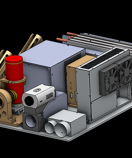
Learn how our M3150 system will revolutionize inspecting Distribution systems.
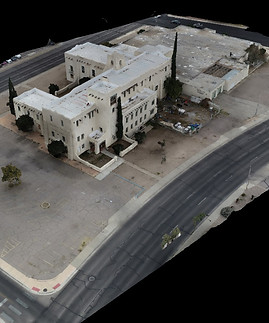
LaSen has the ability to map and model large scale areas for industries such as mining, construction, land development, agriculture and typically can provide full-service deliverables within 48 hours.

LaSen conducts NDT(non-destructive testing) services using our Infrared sensor payloads. Manage your asset's life-cylce by having an IR NDT inspection.
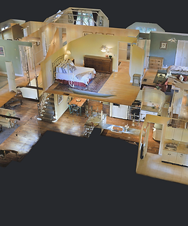
Get interactive, 360 degree As-Builting virtual walkthroughs of your building, house, etc. during the construction phases. Our 360 walkthroughs are measureable utilizing Matterport.

Our specialized OGI inspections are comprised of a HD RGB camera, a mid-wave IR camera specialized for gas, and a TDLAS spectrometer that helps quanitfy gas leaks that are inspected. Our equipment is 0000a approved.
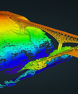
If accuracy or "survey grade" data is what you require, then our LiDAR system can facilitate. We offer a full-range of LiDAR mapping services for the architectural, engineering, and construction industries. See how LaSen can help collect point cloud data for you!

If you have any questions about our services or would like a quote please contact us.
